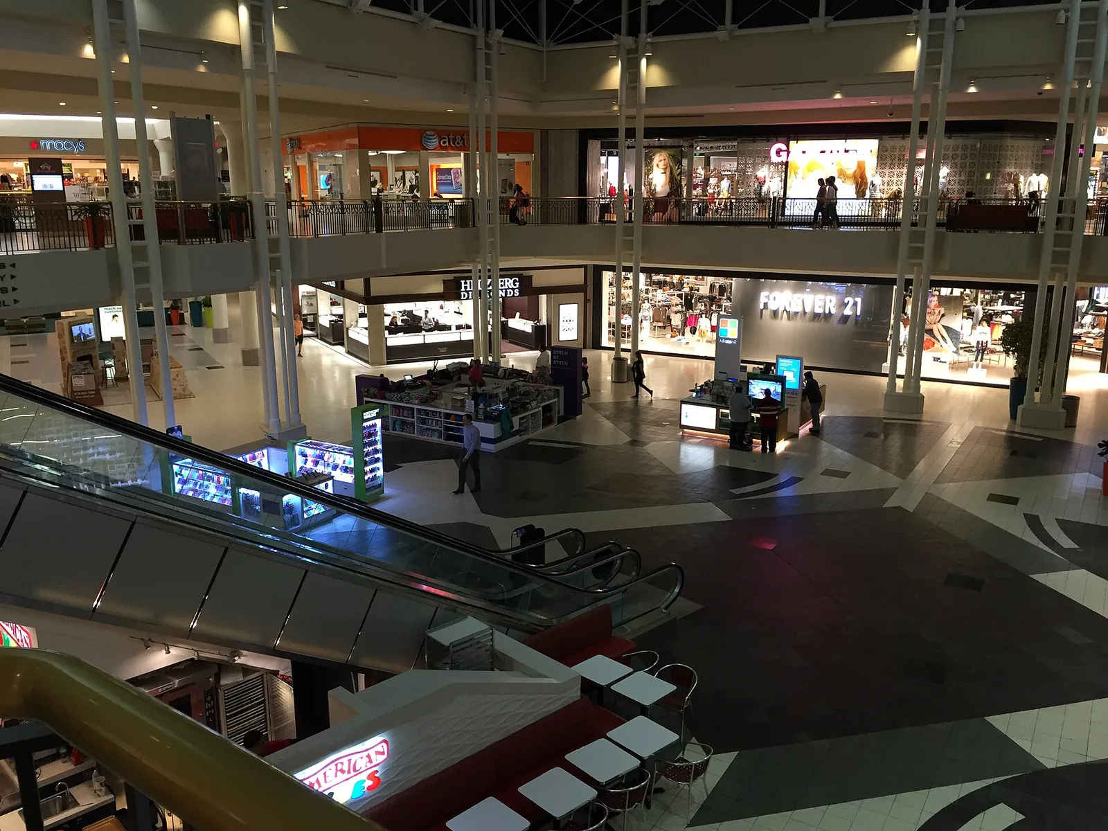
North Point, the 670-acre district around North Point Mall between Mansell and Haynes Bridge roads, spans ZIP codes 30009, 30022 and 30076.
Last checked Oct. 4, 2026. Sources: the City of Alpharetta’s Horizon 2045 Comprehensive Plan (PDF), its North Point LCI page and North Point LCI update (PDF), Fulton County Schools address map data, the state’s 2025 School Grades data, Zillow Research, MARTA and OpenStreetMap.
North Point is the district built around North Point Mall in the early 1990s, on both sides of Georgia 400 at the south end of Alpharetta, with apartments and townhomes around the mall and its shopping centers. The city’s comprehensive plan says rental housing is concentrated in multifamily and mixed-use areas “particularly along the GA 400 corridor.” The Big Creek Greenway runs through the district.
What this means for you
- Zoned high school: split between Milton High (53% of addresses) and Centennial High (43%). Check your address with the district’s Find Your School lookup.
- Home value: $759,646 in ZIP 30009, $668,627 in 30022 and $582,171 in 30076 in August 2026, according to the Zillow Home Value Index.
- Nearest Georgia 400 exits: exit 8, Mansell Road, and exit 9, Haynes Bridge Road.
Part of our Alpharetta neighborhoods guide.
Where it is
The city’s North Point LCI page describes the area “centered on North Point Parkway from Mansell Road to Haynes Bridge Road,” which became a regional destination when North Point Mall opened in 1993. The North Point Livable Centers Initiative plan covers the North Point Parkway and Westside Parkway corridors between Mansell and Haynes Bridge roads. The City Council adopted it in April 2008 and adopted an update on Feb. 21, 2018.
The Horizon 2045 Comprehensive Plan, adopted June 22, 2026, makes North Point its one “growth opportunity” focus area. It says:
- The district covers roughly 670 acres, with about 50 property owners, and much of its building stock is more than 30 years old.
- Visits to the North Point area have dropped 38% since 2019.
- Redeveloping the 100-acre North Point Mall parcel “could become a major catalyst,” though it is only about 15% of the district.
- A MARTA Express Lane Transit station is planned to serve the area.
The plan’s housing strategy is to “prioritize high density development in North Point.”
The district’s map data puts 43% of the area’s Alpharetta addresses in ZIP code 30009, 38% in 30022 and 19% in 30076. Addresses inside city limits get Alpharetta police, fire and trash service.
Schools
Of the addresses in this area in the district’s map data on Oct. 4, this is how they split. Scores are 2025 College and Career Ready Performance Index (CCRPI) figures from the state’s School Grades report.
| Level | School | Share of addresses | 2025 CCRPI |
|---|---|---|---|
| High | Milton High (report card) | 53% | 92.8 |
| High | Centennial High (report card) | 43% | 88.5 |
| High | Alpharetta High (report card) | 4% | 93.0 |
| Middle | Northwestern Middle (report card) | 41% | 87.0 |
| Middle | Haynes Bridge Middle (report card) | 34% | 87.8 |
| Middle | Elkins Pointe Middle (report card) | 21% | 83.5 |
| Middle | Webb Bridge Middle (report card) | 4% | 96.2 |
| Elementary | Hembree Springs Elementary (report card) | 64% | 92.8 |
| Elementary | Mimosa Elementary (report card) | 31% | 64.4 |
| Elementary | New Prospect Elementary (report card) | 5% | 97.9 |
Four of these schools, Haynes Bridge Middle, Elkins Pointe Middle, Hembree Springs Elementary and Mimosa Elementary, are on the district’s list of schools that may be affected by rezoning, so North Point zones could change. Some address points in the district’s data carry no zone; the shares above are of those that do. Every school, with its zone map: Alpharetta public schools.
Home values
According to the Zillow Home Value Index, a modeled typical value for the middle third of homes and not a sale price:
| ZIP code | August 2026 | August 2025 | Change |
|---|---|---|---|
| 30009 | $759,646 | $742,804 | +2.27% |
| 30022 (Zillow files it under Johns Creek) | $668,627 | $663,117 | +0.83% |
| 30076 (Zillow files it under Roswell) | $582,171 | $577,243 | +0.85% |
| Alpharetta, citywide | $716,629 | $718,009 | -0.19% |
Each ZIP code reaches well beyond North Point. More in our home prices guide.
Parks and trails
The Big Creek Greenway runs through North Point. The city lists greenway parking in the North Point Mall area off North Point Parkway between Mansell and Haynes Bridge roads, and a lot on the east side of Haynes Bridge Road south of North Point Parkway. A soft mulch trail circles a wetland between Haynes Bridge Road and Mansell Road. Main access with restrooms is at Rock Mill Park, 3100 Kimball Bridge Road, to the north. See the city’s greenway page and our walking and biking trails guide.
Getting around
- Georgia 400: exit 8, Mansell Road, and exit 9, Haynes Bridge Road, by the exit numbers in OpenStreetMap.
- Downtown: about 2.8 miles from the middle of the area to City Hall by road.
- Airport: about 35 miles to Hartsfield-Jackson Atlanta International Airport. Both are distances measured on the OpenStreetMap road network with the OSRM routing engine, not drive times.
- MARTA: route 140 stops along Haynes Bridge Road and North Point Parkway, and route 85 along Mansell Road. Both serve the Mansell Park and Ride, according to MARTA’s schedule data, and run to North Springs Station.
More in our getting around guide.
Groceries and everyday stores
From OpenStreetMap, on and near Mansell Road just west of the city line:
- Walmart Supercenter, 970 Mansell Road
- ALDI, 600 Mansell Road
- Kroger, 570 East Crossville Road
North Point Mall and the shopping centers around it are inside the district.
How we drew this area
North Point follows the city’s LCI area, between Mansell and Haynes Bridge roads on both sides of Georgia 400. School shares come from every Alpharetta address point inside it in the Fulton County Schools map service, checked Oct. 4, 2026. City limits are from OpenStreetMap’s boundary for Alpharetta. Store locations are © OpenStreetMap contributors.
Frequently asked questions
Where is the North Point area of Alpharetta?
The city’s North Point plans cover the North Point Parkway and Westside Parkway corridors between Mansell Road and Haynes Bridge Road, on both sides of Georgia 400. The comprehensive plan calls it a roughly 670-acre district anchored by North Point Mall.
What high school is North Point Alpharetta zoned for?
It is split. Of the addresses in the Fulton County Schools map data, 53% are zoned for Milton High, 43% for Centennial High and 4% for Alpharetta High. Check one address with the district’s zone lookup.
What is happening to North Point Mall?
The city’s Horizon 2045 Comprehensive Plan names North Point its main growth opportunity and says redevelopment of the 100-acre mall parcel could be a catalyst. It notes visits to the area have dropped 38% since 2019.
What Georgia 400 exits serve North Point?
Exit 8, Mansell Road, and exit 9, Haynes Bridge Road, at the south and north ends of the district.
Have your say